Indonésie 印度尼西亚 => Pays de Beau Bois

Indonésie 印度尼西亚 => Pays de Beau Bois

Les artisans

Sélection des meubles indonésiens

Les objets

Histoire des meubles indonésiens

Indonésie 印度尼西亚 => Pays de Beau Bois

Mise à jour 2023-11-09 09:24:11

L'Indonésie est un pays situé en Asie dont la capitale est Jakarta. La hiérarchie des divisions administratives est la suivante : L'Indonésie est subdivisée en provinces, qui se divisent à leur tour en régences (kabupaten), villes (kota), qui se divisent à leur tour en districts, qui se divisent à leur tour en bourgades, villages.

Les noms des pays/territoires du monde sont donnés en Français et Chinois. Cette collection des précieuses terres fermes du monde que toute l'humanité partage inclut non seulement les pays indépendants, mais aussi des régions spécifiques qui ne sont pas membre de l'ONUOrganisation des Nations Unies: Nous, peuples des Nations Unies ... Une ONU plus forte pour un monde meilleur. Veuillez aussi consulter les noms des pays en masculin et féminin en Français.

GéoPays    Fermer
Indonésie | Pays/Territoires | Régions en Chine | Provinces de Chine | Régions en France | Départements de France | Provinces du Monde | Villes/Villages | Localités | Continents du Monde | Vins AOP

151

id
Pays
Pays en Anglais
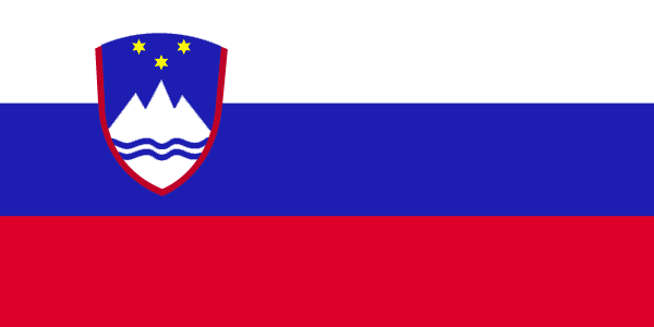
Slovenia
Pays
Slovénie
countryucasefr
SLOVENIE
Pays en Chinois
Pays en Espagnol
Eslovenia
Pays en Italien
La Slovenia
Pays en Portugais
Slovenia
Pays en Allemand
Slowenien
countrypy
si1 luo4 wen2 ni2 ya4
countrylocal
Slovenija
countryfull
Slovenia
countrynm
Slovenia
ISO2
SI
ISO3
SVN
countrycodeisono
705
countrycodevehicle
SLO
countrycodeolympic
SLO
countrycodeirs
SI
countrycodeirsfr
SI
countrycodeirsmixt
SI
♀Féminin
18
6
129
languagesfr
Slovène
2
currency
tolar
currencyfr
tolar
currencyisocode
SIT
currencyisocodefull
SIT 705
currencypxcode
SIT
currencysymbol
SlT
currencysubdivision
100 stotinov (stotins)
currencyregime
m.float
currencyvalue
0.0051
nationalityfr
Slovénienne
Capitale
Ljubljana
capitalfr
Ljubljana
Préfixe Tél.
386
Superficie km2
20 251
arealand
20 151
areawater
122
landarablerate
0.1148
landforestrate
0.55
coastline
46.6
summit
Triglav 2 863 m.
boundarycountries
Italie, Autriche, Hongrie, Croatie.
timezonedeltabegin
1
flaglink
maplink
si-map.gif
outlinemaplink
si.gif
visapassenger
-1
maincities
Maribor, Koper, Kranj, Celje, Trbovlje, Jesenice.
largestcity
Ljubljana
largestcitypopulation
278 000
rankpopulation
142
Population
1 995 000
rankgdp
62
gdp
27749000000
rankgdpppp
75
gdpppp
38204000000
rankgni
65
gni
23777000000
rankincomeorigin
50
rankincome
50
income
11920
rankincomeppp
45
incomeppp
19100
lifeexpectation
75.73
alphabetizationrate
1
natalityrate
0.00919
mortalityrate
0.01024
mortalityrateinfantile
0.00438
hdi
0.881
urbanization
0.491
precipitation
1393
nationalevent
Independence Day/Statehood Day
nationaleventfr
Jour de l'Indépendance
nationalholiday
25 June (1991)
Date de naissance aaaa-mm-jj
1991-06-25 00:00:00
8
8
location
Central Europe, eastern Alps bordering the Adriatic Sea, between Austria and Croatia
terrain
a short coastal strip on the Adriatic, an alpine mountain region adjacent to Italy and Austria, mixed mountains and valleys with numerous rivers to the east
naturalresources
lignite coal, lead, zinc, mercury, uranium, silver
5
Web
rgbback
16777215
todate
1

152

id
Pays
Pays en Anglais
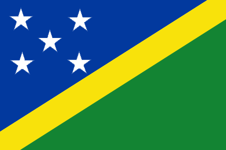
Solomon Islands
Pays
Salomon
countryucasefr
SALOMON
Pays en Chinois
Pays en Espagnol
Islas De Solomon
Pays en Italien
Isole Di Solomon
Pays en Portugais
Consoles De Solomon
Pays en Allemand
Inseln Solomon
countryfull
Solomon Islands
countrynm
Solomon Islands
ISO2
SB
ISO3
SLB
countrycodeisono
090
countrycodeolympic
SOL
countrycodeirs
BP
countrycodeirsfr
BP
countrycodeirsmixt
BP
18
6
51
languagesfr
Anglais
94
currency
dollar
currencyfr
dollar des Salomon
currencyisocode
SBD
currencyisocodefull
SBD 090
currencypxcode
SBD
currencysymbol
SI$
currencysubdivision
100 cents
currencyregime
composite
currencyvalue
0.1358
Capitale
Honiara
capitalfr
Honiara
Préfixe Tél.
677
Superficie km2
28 450
arealand
27 540
areawater
910
landarablerate
0.015
landforestrate
0.888
coastline
5313
summit
Mount Makarakomburu 2 447 m.
timezonedeltabegin
11
flaglink
maplink
sbcolor.gif
outlinemaplink
sb.gif
visapassenger
-1
maincities
Kirakira, Auki, Tangarare, Gizo, Gateri.
largestcity
Honiara
largestcitypopulation
53 000
rankpopulation
163
Population
457 000
rankgdp
178
gdp
253000000
rankgdpppp
161
gdpppp
800000000
rankgni
200
gni
255000000
rankincomeorigin
158
rankincome
172
income
560
rankincomeppp
174
incomeppp
1710
lifeexpectation
72.38
alphabetizationrate
0.77
natalityrate
0.0316
fecondity
4.42
mortalityrate
0.00404
mortalityrateinfantile
0.02209
growthrate
0.02756
hdi
0.632
urbanization
0.202
precipitation
3290
nationalevent
Independence Day
nationaleventfr
Jour de l'Indépendance
nationalholiday
7 July (1978)
Date de naissance aaaa-mm-jj
1978-07-07 00:00:00
5
7
location
Oceania, group of islands in the South Pacific Ocean, east of Papua New Guinea
terrain
mostly rugged mountains with some low coral atolls
naturalresources
fish, forests, gold, bauxite, phosphates, lead, zi
9
rgbback
16777215
todate
1

153

id
Pays
Pays en Anglais
Somalia
Pays
Somalie
countryucasefr
SOMALIE
Pays en Chinois
Pays en Espagnol
Somalia
Pays en Italien
La Somalia
Pays en Portugais
Somália
Pays en Allemand
Somalia
countrypy
suo3 ma3 li3
countrylocal
Somalia
countryfull
Somalia
countrynm
Somalia
ISO2
SO
ISO3
SOM
countrycodeisono
706
countrycodevehicle
SO
countrycodeolympic
SOM
countrycodeirs
SO
countrycodeirsfr
SO
countrycodeirsmixt
SO
♀Féminin
2
187
languagesfr
Somali, Arabe
95
currency
shilling
currencyfr
shilling
currencyisocode
SOS
currencyisocodefull
SOS 706
currencypxcode
SOS
currencysymbol
So. Sh.
currencysubdivision
100 centesimi
currencyregime
float
currencyvalue
0.00033
nationalityfr
Somalienne
Capitale
Mogadishu
capitalfr
Mogadiscio
Préfixe Tél.
252
Superficie km2
528 657
arealand
627 337
areawater
10 320
landarablerate
0.0166
landforestrate
0.12
coastline
3025
summit
Shimbiris 2 450 m.
boundarycountries
Kenya, Ethiopie, Somaliland.
timezonedeltabegin
3
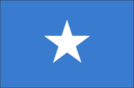
flaglink
maplink
socolor.gif
outlinemaplink
soout.gif
visapassenger
-1
maincities
Baioa, Kisimayu, Merca, Gioher, Boromo.
largestcity
Mogadishu
largestcitypopulation
997 000
rankpopulation
79
Population
9 626 000
rankgni
158
gni
1350000000
rankincomeorigin
208
rankincome
213
income
180
lifeexpectation
47.71
alphabetizationrate
0.3765
natalityrate
0.04604
mortalityrate
0.0173
mortalityrateinfantile
0.11852
urbanization
0.279
nationalevent
Foundation of the Somali Republic
nationaleventfr
Fondation de la République du Somali
nationalholiday
1 July (1960)
Date de naissance aaaa-mm-jj
1960-07-01 00:00:00
7
1
location
Eastern Africa, bordering the Gulf of Aden and the Indian Ocean, east of Ethiopia
terrain
mostly flat to undulating plateau rising to hills in north
naturalresources
uranium and largely unexploited reserves of iron o
9
rgbback
16777215
todate
1

154

id
Pays
Pays en Anglais
South Africa
Pays
Afrique du Sud
countryucasefr
AFRIQUE DU SUD
Pays en Chinois
Pays en Espagnol
África Del sur
Pays en Italien
L'Africa Del sud
Pays en Portugais
África Sul
Pays en Allemand
SüdcAfrika
countrypy
nan2 fei1
countrylocal
South Africa
countryfull
South Africa
countrynm
South Africa
ISO2
ZA
ISO3
ZAF
countrycodeisono
710
countrycodevehicle
ZA
countrycodeolympic
RSA
countrycodeirs
SF
countrycodeirsfr
SF
countrycodeirsmixt
SF
countrycode
27
♀Féminin
15
7
1
languagesfr
Afrikaans
96
currency
rand
currencyfr
rand
currencyisocode
ZAR
currencyisocodefull
ZAR 710
currencypxcode
ZAR
currencysymbol
R
currencysubdivision
100 cents
currencyregime
float
currencyvalue
0.1453
nationalityfr
Africaine du Sud
Capitale
Pretoria
capitalfr
Pretoria
Préfixe Tél.
27
Superficie km2
1 219 912
arealand
1 219 912
landarablerate
0.1213
landforestrate
0.073
coastline
2798
summit
Injasuti 3 408 m.
boundarycountries
Namibie, Botswana, Zimbabwe, Mozambique, Swaziland, Lesotho.
timezonedeltabegin
2
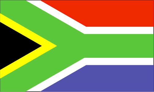
flaglink
maplink
zacolor.gif
outlinemaplink
zaout.gif
visapassenger
-1
maincities
Cape Town (Le Cap), Johannesburg, Durban, Port Elizabeth, Umhlali, East London.
largestcity
Pretoria (administrative) Cape Town (legislative)
largestcitypopulation
2 727 000
rankpopulation
27
Population
45 829 000
rankgdp
29
gdp
159886000000
rankgdpppp
19
gdpppp
474137000000
rankgni
33
gni
125960000000
rankincomeorigin
94
rankincome
104
income
2750
rankincomeppp
76
incomeppp
10130
lifeexpectation
44.1
alphabetizationrate
0.8605
natalityrate
0.01909
fecondity
2.61
mortalityrate
0.0204
mortalityrateinfantile
0.06284
hdi
0.684
precipitation
520
nationalevent
Freedom Day
nationaleventfr
Jour de la Liberté
nationalholiday
27 April (1994)
Date de naissance aaaa-mm-jj
1994-04-27 00:00:00
1
11
location
Southern Africa, at the southern tip of the continent of Africa
terrain
vast interior plateau rimmed by rugged hills and narrow coastal plain
naturalresources
gold, chromium, antimony, coal, iron ore, manganes
cooking
Fruits Exotiques.
9
Web
rgbback
16777215
todate
1
Notes
Fruits Exotiques.

155

id
Pays
Pays en Anglais
Spain
Pays
Espagne
countryucasefr
ESPAGNE
Pays en Chinois
Pays en Espagnol
España
Pays en Italien
La Spagna
Pays en Portugais
Spain
Pays en Allemand
Spanien
countrypy
xi1 ban1 ya2
countrylocal
España
countryfull
Spain
countrynm
Spain
ISO2
ES
ISO3
ESP
countrycodeisono
724
countrycodevehicle
E
countrycodeolympic
ESP
countrycodeirs
SP
countrycodeirsfr
ES
countrycodeirsmixt
ES
countrycode
34
countrycodefr
34
♀Féminin
1
11
7
131
languagesfr
Espagnol
2
currency
euro
currencyfr
Euro
currencyisocode
EUR
currencyisocodefull
EUR 978
currencypxcode
EUR
currencysymbol
currencysubdivision
100 cents
currencyregime
float
currencyvalue
1.2203
nationality
Spanish
nationalityfr
Espagnole
Capitale
Madrid
capitalfr
Madrid
Préfixe Tél.
34
Superficie km2
504 750
arealand
499 542
areawater
5 240
landarablerate
0.286
landforestrate
0.288
coastline
4964
summit
Mulhacén 3 478 m.
boundarycountries
Portugal, France, Andorre, Maroc
timezonedeltabegin
1
zipcodelength
5
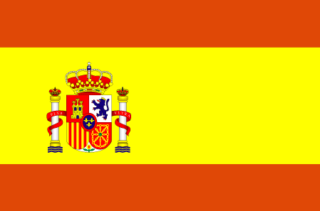
flaglink
maplink
sp-map.gif
outlinemaplink
es.gif
maincities
Barcelone, Valence, Seville, Saragosse, Málaga, Bilbao, Valladolid, Palma de Majorque.
largestcity
Madrid
largestcitypopulation
4 072 000
rankpopulation
29
Population
41 101 000
rankgdp
9
gdp
838652000000
rankgdpppp
13
gdpppp
920292000000
rankgni
9
gni
700475000000
rankincomeorigin
36
rankincome
31
income
17040
rankincomeppp
34
incomeppp
22150
lifeexpectation
79.37
alphabetizationrate
0.99
natalityrate
0.01011
mortalityrate
0.00955
mortalityrateinfantile
0.00448
hdi
0.918
precipitation
456
nationalevent
Hispanic Day
nationaleventfr
Jour Hispanique
nationalholiday
12 October
Date de naissance aaaa-mm-jj
2000-10-12 00:00:00
7
5
location
Southwestern Europe, bordering the Bay of Biscay, Mediterranean Sea, North Atlantic Ocean, and Pyrenees Mountains, southwest of France
terrain
large, flat to dissected plateau surrounded by rugged hills; Pyrenees in north
naturalresources
coal, lignite, iron ore, uranium, mercury, pyrites
cooking
Paëlla.
5
Web
rgbback
16777215
todate
1
Notes
Paëlla.

Plus+
A | B | C | D | E | F | G | H | I | J | K | L | M | N | O | P | Q | R | S | T | U | V | W | X | Y | Z
 

Envoyez vos commentaires (44)

44. Visiteur *.*.48.* - 2025-03-04 12:05:29
We are dedicated to the meticulous maintenance and repair of your truck’s braking system.
40. Visiteur *.*.35.* - 2024-12-30 20:50:31
fwaga
Email Web

Veuillez recopier la chaîne :
Texte à recopier.

Chaussures Chinoises > Slovénie 斯洛文尼亚 => Indonésie 印度尼西亚 => Pays de Beau Bois
  

Envie de venir ? | Appelez-nous 7/704 67 79 04 87 (Service Epices)

Fenêtre contextuelle    Fermer
Veuillez patienter...