Indonésie 印度尼西亚 => Pays de Beau Bois

Indonésie 印度尼西亚 => Pays de Beau Bois

Les artisans

Sélection des meubles indonésiens

Les objets

Histoire des meubles indonésiens

Indonésie 印度尼西亚 => Pays de Beau Bois

Mise à jour 2023-11-09 09:24:11

L'Indonésie est un pays situé en Asie dont la capitale est Jakarta. La hiérarchie des divisions administratives est la suivante : L'Indonésie est subdivisée en provinces, qui se divisent à leur tour en régences (kabupaten), villes (kota), qui se divisent à leur tour en districts, qui se divisent à leur tour en bourgades, villages.

Les noms des pays/territoires du monde sont donnés en Français et Chinois. Cette collection des précieuses terres fermes du monde que toute l'humanité partage inclut non seulement les pays indépendants, mais aussi des régions spécifiques qui ne sont pas membre de l'ONUOrganisation des Nations Unies: Nous, peuples des Nations Unies ... Une ONU plus forte pour un monde meilleur. Veuillez aussi consulter les noms des pays en masculin et féminin en Français.

GéoPays    Fermer
Indonésie | Pays/Territoires | Régions en Chine | Provinces de Chine | Régions en France | Départements de France | Provinces du Monde | Villes/Villages | Localités | Continents du Monde | Vins AOP

86

id
Pays
Pays en Anglais
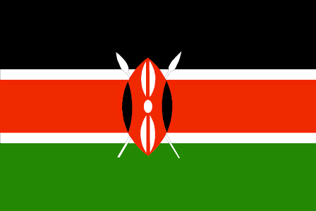
Kenya
Pays
Kenya
countryucasefr
KENYA
Pays en Chinois
Pays en Espagnol
Kenia
Pays en Italien
Il Kenia
Pays en Portugais
Kenya
Pays en Allemand
Kenia
countrypy
ken3 ni2 ya4
countrylocal
Kenya
countryfull
Kenya
countrynm
Kenya
ISO2
KE
ISO3
KEN
countrycodeisono
404
countrycodevehicle
EAK
countrycodeolympic
KEN
countrycodeirs
KE
countrycodeirsfr
KE
countrycodeirsmixt
KE
countrycode
254
♂Masulin
15
6
151
languagesfr
Swahili, Anglais
143
currency
shilling
currencyfr
shilling du Kenya
currencyisocode
KES
currencyisocodefull
KES 404
currencypxcode
KES
currencysymbol
K Sh
currencysubdivision
100 cents
currencyregime
float
currencyvalue
0.013
nationalityfr
Kenyane
Capitale
Nairobi
capitalfr
Naïrobi
Préfixe Tél.
254
Superficie km2
582 646
arealand
569 250
areawater
13 400
landarablerate
0.0703
landforestrate
0.3
coastline
536
summit
Mount Kenya 5 199 m.
boundarycountries
Ouganda, Soudan, Ethiopie, Somalie, Tanzanie.
timezonedeltabegin
3
flaglink
maplink
kecolor.gif
outlinemaplink
keout.gif
visapassenger
-1
maincities
Mombasa, Kisumi, Nakuru, Eldoret, Thika, Nyeri, Nanyuki, Kitale, Malindi, Kericho.
largestcity
Nairobi
largestcitypopulation
3 639 362
rankpopulation
34
Population
31 916 000
rankgdp
82
gdp
14376000000
rankgdpppp
81
gdpppp
33099000000
rankgni
84
gni
12788000000
rankincomeorigin
173
rankincome
187
income
400
rankincomeppp
189
incomeppp
1030
lifeexpectation
44.94
alphabetizationrate
0.8425
natalityrate
0.02782
fecondity
4
mortalityrate
0.01631
mortalityrateinfantile
0.06262
hdi
0.489
urbanization
0.925
precipitation
1063
nationalevent
Independence Day
nationaleventfr
Jour de l'Indépendance
nationalholiday
12 December (1963)
Date de naissance aaaa-mm-jj
1963-12-12 00:00:00
10
4
location
Eastern Africa, bordering the Indian Ocean, between Somalia and Tanzania
terrain
low plains rise to central highlands bisected by Great Rift Valley; fertile plateau in west
naturalresources
gold, limestone, soda ash, salt, rubies, fluorspar
9
Web
rgbback
16777215
todate
1

87

id
Pays
Pays en Anglais
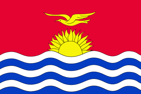
Kiribati
Pays
Kiribati
countryucasefr
KIRIBATI
Pays en Chinois
Pays en Espagnol
Kiribati
Pays en Italien
Kiribati
Pays en Portugais
Kiribati
Pays en Allemand
Kiribati
countrypy
ji2 li3 ba1 si1
countrylocal
Kiribati, Kiribas
countryfull
Kiribati
countrynm
Kiribati
ISO2
KI
ISO3
KIR
countrycodeisono
296
countrycodeolympic
KIR
countrycodeirs
KR
countrycodeirsfr
KR
countrycodeirsmixt
KRB
♂Masulin
15
6
51
languagesfr
Anglais
10
currency
dollar
currencyfr
dollar australien
currencyisocode
AUD
currencyisocodefull
AUD 036
currencypxcode
AUD
currencysymbol
A$
currencysubdivision
100 cents
currencyregime
float
currencyvalue
0.7485
Capitale
Tarawa
capitalfr
Tarawa
Préfixe Tél.
686
Superficie km2
717
arealand
811
landforestrate
0.384
coastline
1143
summit
Joes Hill 81 m.
timezonedeltabegin
12
flaglink
maplink
kicolor.gif
visapassenger
-1
maincities
Ooma.
largestcity
Tarawa
rankpopulation
190
Population
96 000
rankgdp
185
gdp
55000000
rankgni
207
gni
83000000
rankincomeorigin
144
rankincome
157
income
860
lifeexpectation
61.32
natalityrate
0.03099
fecondity
3.6
mortalityrate
0.00849
mortalityrateinfantile
0.0499
growthrate
0.0225
nationalevent
Independence Day
nationaleventfr
Jour de l'Indépendance
nationalholiday
12 July (1979)
Date de naissance aaaa-mm-jj
1979-07-12 00:00:00
6
8
location
Oceania, group of 33 coral atolls in the Pacific Ocean, straddling the equator; the capital Tarawa is about one-half of the way from Hawaii to Australia; note - on 1 January 1995, Kiribati proclaimed that all of its territory lies in the same time zone as
terrain
mostly low-lying coral atolls surrounded by extensive reefs
naturalresources
phosphate (production discontinued in 1979)
9
rgbback
16777215
todate
1

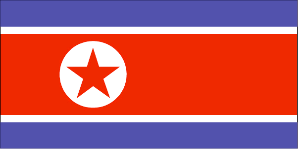
88

id
Pays
Pays en Anglais
Korea, North
Pays
Corée du Nord
countryucasefr
COREE DU NORD
Pays en Chinois
Pays en Espagnol
Corea, Del norte (Representante Democrático De la Gente)
Pays en Italien
La Corea, Del nord (Rappresentante Democratico Della Gente)
Pays en Portugais
Coreia, Norte (Representante Democrático Dos Povos)
Pays en Allemand
Korea, Nord (Demokratischer VölkercRepräsentant)
countrypy
bei3 han2, bei3 chao2 xian3
countrylocal
Choson
countryfull
Korea, North
countrynm
Korea, North
ISO2
KP
ISO3
PRK
countrycodeisono
408
countrycodeolympic
PRK
countrycodeirs
KN
countrycodeirsfr
KN
countrycodeirsmixt
KN
♀Féminin
6
1
92
languagesfr
Coréen
58
currency
won
currencyfr
won
currencyisocode
KPW
currencyisocodefull
KPW 408
currencypxcode
KPW
currencysymbol
Wn
currencysubdivision
100 chon
currencyvalue
0.4545
nationalityfr
Coréenne
Capitale
Pyongyang
capitalfr
Pyongyang
Préfixe Tél.
850
Superficie km2
120 540
arealand
120 410
areawater
130
landarablerate
0.1412
landforestrate
0.682
coastline
2495
summit
Paektu-san 2 744 m.
boundarycountries
Chine, Corée du Sud.
timezonedeltabegin
9
flaglink
maplink
kpcolor.gif
outlinemaplink
kpout.gif
visapassenger
-1
maincities
Ch'ongjin, Chinnamp'o, Sinuiju, Hungnam, Wonsan, Kaesong, Hamhung, Kimch'aek, Haeju, Sariwon.
largestcity
Pyongyang
largestcitypopulation
3 245 305
rankpopulation
45
Population
22 612 000
rankincome
164
income
735
lifeexpectation
70.79
alphabetizationrate
0.999
natalityrate
0.01761
mortalityrate
0.00693
mortalityrateinfantile
0.02566
precipitation
1001
nationalevent
Founding of the Democratic People's Republic of Korea (DPRK)
nationaleventfr
Création de la République Populaire de Corée
nationalholiday
9 September (1948)
Date de naissance aaaa-mm-jj
1948-09-09 00:00:00
5
1
location
Eastern Asia, northern half of the Korean Peninsula bordering the Korea Bay and the Sea of Japan, between China and South Korea
terrain
mostly hills and mountains separated by deep, narrow valleys; coastal plains wide in west, discontinuous in east
naturalresources
coal, lead, tungsten, zinc, graphite, magnesite, i
9
rgbback
16777215
todate
1

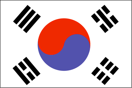
89

id
Pays
Pays en Anglais
Korea, South
Pays
Corée du Sud
countryucasefr
COREE DU SUD
Pays en Chinois
Pays en Espagnol
Corea, del sur (república de)
Pays en Italien
La Corea, del sud (Repubblica di)
Pays en Portugais
Coreia, sul (república de)
Pays en Allemand
Korea, Süd (Republik von)
countrypy
han2 guo2, guang1 zhou1
countrylocal
Han-guk
countryfull
Korea, South
countrynm
Korea, South
ISO2
KR
ISO3
KOR
countrycodeisono
410
countrycodevehicle
ROK
countrycodeolympic
KOR
countrycodeirs
KS
countrycodeirsfr
CR
countrycodeirsmixt
KR
countrycode
82
♀Féminin
15
6
92
languagesfr
Coréen
59
currency
won
currencyfr
won
currencyisocode
KRW
currencyisocodefull
KRW 410
currencypxcode
KRW
currencysymbol
W
currencysubdivision
100 chon [*]
currencyregime
float
currencyvalue
0.00099
nationalityfr
Coréenne
Capitale
Soul
capitalfr
Séoul
Préfixe Tél.
82
Superficie km2
98 992
arealand
98 190
areawater
290
landarablerate
0.1744
landforestrate
0.633
coastline
2413
summit
Halla-san 1 950 m.
boundarycountries
Corée du Nord.
timezonedeltabegin
9
flaglink
maplink
krcolor.gif
outlinemaplink
krout.gif
maincities
Pusan, Taegu, Inch'on, Kwangju, Taejon, Ulsan, Masan, Sunwon, Chonju.
largestcity
Soul
largestcitypopulation
21 738 345
rankpopulation
26
Population
47 912 000
rankgdp
11
gdp
605331000000
rankgdpppp
14
gdpppp
861042000000
rankgni
11
gni
576426000000
rankincomeorigin
49
rankincome
49
income
12030
rankincomeppp
47
incomeppp
18000
lifeexpectation
75.36
alphabetizationrate
0.9796
natalityrate
0.0126
mortalityrate
0.00603
mortalityrateinfantile
0.00731
precipitation
1371
nationalevent
Liberation Day
nationaleventfr
Jour de la Libération
nationalholiday
15 August (1945)
Date de naissance aaaa-mm-jj
1945-08-15 00:00:00
2
10
location
Eastern Asia, southern half of the Korean Peninsula bordering the Sea of Japan and the Yellow Sea
terrain
mostly hills and mountains; wide coastal plains in west and south
naturalresources
coal, tungsten, graphite, molybdenum, lead, hydrop
cooking
Nouilles Piquantes: Climant froid.
8
Web
rgbback
16777215
todate
1
Notes
Nouilles Piquantes: Climant froid.

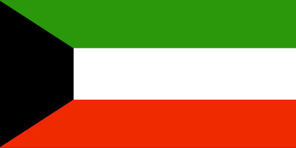
90

id
Pays
Pays en Anglais
Kuwait
Pays
Koweït
countryucasefr
KOWEIT
Pays en Chinois
Pays en Espagnol
Kuwait
Pays en Italien
Il Kuwait
Pays en Portugais
Kuwait
Pays en Allemand
Kuwait
countrypy
ke1 wei1 te4
countrylocal
Al Kuwayt
countryfull
Kuwait
countrynm
Kuwait
ISO2
KW
ISO3
KWT
countrycodeisono
414
countrycodevehicle
KWT
countrycodeolympic
KUW
countrycodeirs
KU
countrycodeirsfr
KU
countrycodeirsmixt
KU
countrycode
965
♂Masulin
12
4
3
languagesfr
Arabe
144
currency
dinar
currencyfr
dinar koweïtien
currencyisocode
KWD
currencyisocodefull
KWD 414
currencypxcode
KWD
currencysymbol
KD
currencysubdivision
1,000 fils
currencyregime
composite
currencyvalue
3.4258
nationalityfr
Kowaïtienne
Capitale
Kuwait City
capitalfr
Koweït city
Préfixe Tél.
965
Superficie km2
17 818
arealand
17 820
landarablerate
0.0034
landforestrate
0.003
coastline
499
summit
306 m.
boundarycountries
Iraq, Arabie Saoudite.
timezonedeltabegin
3
flaglink
maplink
kwcolor.gif
outlinemaplink
kwout.gif
visapassenger
-1
maincities
Salmiya, Hawalli, Al Jahra, Mina Ahmadi, Al Ahmadi.
largestcity
Kuwait City
largestcitypopulation
2 388 688
rankpopulation
138
Population
2 396 000
rankgdp
57
gdp
41748000000
rankgdpppp
72
gdpppp
43248000000
rankgni
56
gni
43048000000
rankincomeorigin
34
rankincome
29
income
17960
rankincomeppp
43
incomeppp
19480
lifeexpectation
76.65
alphabetizationrate
0.73
natalityrate
0.02183
mortalityrate
0.00245
mortalityrateinfantile
0.01057
precipitation
108
nationalevent
National Day
nationaleventfr
Jour National
nationalholiday
25 February (1950)
Date de naissance aaaa-mm-jj
1950-02-25 00:00:00
7
3
location
Middle East, bordering the Persian Gulf, between Iraq and Saudi Arabia
terrain
flat to slightly undulating desert plain
naturalresources
petroleum, fish, shrimp, natural gas
9
Web
rgbback
16777215
todate
1

Plus+
A | B | C | D | E | F | G | H | I | J | K | L | M | N | O | P | Q | R | S | T | U | V | W | X | Y | Z
 

Envoyez vos commentaires (44)

44. Visiteur *.*.48.* - 2025-03-04 12:05:29
We are dedicated to the meticulous maintenance and repair of your truck’s braking system.
40. Visiteur *.*.35.* - 2024-12-30 20:50:31
fwaga
Email Web

Veuillez recopier la chaîne :
Texte à recopier.

Chaussures Chinoises > Kenya 肯尼亚 => Indonésie 印度尼西亚 => Pays de Beau Bois
  

Envie de venir ? | Appelez-nous 7/704 67 79 04 87 (Service Epices)

Fenêtre contextuelle    Fermer
Veuillez patienter...